
Eden Prairie Neighbors Around a Block
Each public source answers a narrow block question. The city map identifies parcels around an address. Hennepin property records add assessment, tax, sales, and parcel context. RecordEASE may show a recorded transfer for the legal parcel. None of those sources is a complete list of people at an address. Use them to distinguish a parcel owner, a recorded party, a voter-registration match, and a public civic contact instead of treating every name as a current neighbor.
| Block source | What it can show | Access route |
|---|---|---|
| Eden Prairie GIS parcels | Adjacent geometry, address, PID, lot/block, addition, district, ZIP, and owner/mailing schema. | Public map or REST service, updated quarterly. |
| Hennepin Property Information | Tax, assessment, sales, parcel description, and recent-recording context for one PID. | Address, PID, addition, or map search for each selected parcel. |
| Hennepin RecordEASE | Recorded deeds, liens, mortgages, and transfer history for a legal parcel. | Free index account; images through Pro, terminal, or copy route. |
| Minnesota voter lookup | A match for one named person at a submitted address. | Individual match tool, not a street or block browser. |
| Neighborhood Crime Watch | A police-supported route to a block coordinator or program contact. | Voluntary program; it is not a participant roster. |
| Community Foundation directory | Public contacts for local civic and community organizations. | Searchable public organization directory, not a member list. |
On an Eden Prairie block, a parcel owner's mailing address can differ from the Eden Prairie situs address. A recorded deed can name a trustee, representative, or organization. A voter result confirms only the submitted person and address match. These roles may overlap, but they should not be merged without an independent, dated record.
Select Eden Prairie Neighbor Parcels
Begin by locating the target address in the city parcel service. Record the PID, address components, geometry, addition, lot/block, ZIP, and applicable district fields. Then identify the parcels that actually touch or sit near the target. House numbers do not define adjacency. A parcel may be separated by a road, alley, creek, common area, or a parent/child parcel relationship, so the lines on the map matter more than a sequence of street numbers.
- Parcel
- A mapped unit of land with a separate PID or legal relationship used in county property records.
- PID
- The 13-digit Hennepin property identification number that connects a mapped parcel to county data.
- Geometry
- The mapped shape and location of a parcel, used to decide whether another parcel is adjacent or simply nearby.
Use the narrowest geographic group that answers the question. For an Eden Prairie block, the city service documents a maximum query count of 2,000 records and a legal-use note; that is a reason to inspect selected Eden Prairie parcels, not to collect a citywide list.
Eden Prairie GIS for Neighbors
The Eden Prairie public parcel service provides the practical map-to-record bridge for a neighbor search. Its schema includes address components, Display_PID and Parent_PID, lot/block and addition fields, owner and mailing-address fields, neighborhood and school-district fields, and update information. The map is useful for selecting and describing parcels. It does not establish that every person connected to a parcel currently lives there.
See the city's public parcel-service view before selecting the target block.
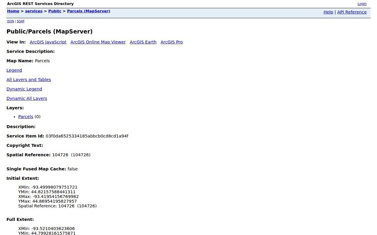
The Eden Prairie parcel screen supplies the shared geography for the next step, where each selected PID is checked separately in the county property record.
Map Eden Prairie Neighbors by Parcel
Move from one Eden Prairie address to the surrounding parcels in a fixed order. City GIS supports map panning and parcel clicks, while its query service documents geometry, spatial relationship, distance, out-fields, and result-count controls. A buffer or intersection query can select nearby features when the service supports the chosen relationship. Map clicks are the simplest public method. For each parcel, follow the PID to Hennepin Property Information and use the legal description only when a recorded transfer must be checked.
- Find the target Eden Prairie address or PID in the parcel map and save the selected parcel's identifiers and geometry.
- Pan or click the parcels that share a boundary or sit within the chosen nearby area. Label the relationship, especially when a road, creek, or common area intervenes.
- Open each selected PID in Hennepin Property Information for tax, assessment, sales, and legal-description context.
- Use the owner and mailing fields as parcel data, not a conclusion about who occupies the address. Record the result date because the GIS layer changes quarterly.
- When a transfer history matters, search the same legal description in RecordEASE and retain the document number, party role, and recorded date.
For a full named-street record chain rather than an immediate block, use the Eden Prairie street directory. That workflow expands from a selected parcel to the address sequence along the street.
Note: A map neighbor is a geographic relationship, not a statement about household membership or private contact information.
Eden Prairie Neighbor Query Controls
The Eden Prairie city query endpoint makes the parcel-selection method reproducible. Its documented controls include an input geometry, geometry type, spatial relationship, distance and units, output fields, return geometry, result count, ordering, and pagination. Preserve the date, target PID, selected geometry, and source URL with any notes. That record helps explain why one parcel was included and another was not, especially in condominium, common-area, or irregular-boundary situations.
Review the public Eden Prairie parcel query endpoint for the available spatial and result controls.
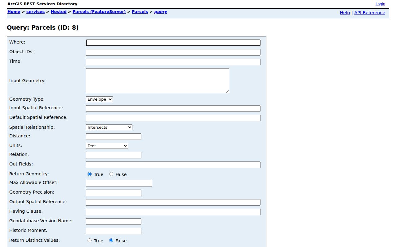
Using a saved geometry and PID narrows the inquiry to the relevant parcels while respecting the service's public-viewer purpose and query limits.
Eden Prairie Voter Limits
For Eden Prairie, Minnesota's voter lookup is a person-and-address match service, not a way to browse a block. It requires a first name, last name, date of birth, and an address mode using ZIP or county, then city or township, house number, and street. A result is useful for the submitted match only. A nonmatch has its own instructions and does not prove that someone never registered. New or changed applications can take time to appear even though the public tool says its data update nightly.
The public voter-information list is different. Under Minn. Stat. §201.091, an eligible registered Minnesota voter can request a defined geographic list subject to certification and purpose restrictions. The form offers city, precinct, ward, county, and other areas, but it is not a general neighbor directory. Protected Safe at Home addresses are withheld from ordinary address results.
Eden Prairie Neighbor Contact Paths
Public civic contacts offer a better community layer than an inferred list of residents. The Eden Prairie Community Foundation directory is searchable and alphabetized, connecting more than 80 local organizations. Use it to find an Eden Prairie organization's public contact channel or event information. It does not publish a citywide membership or neighborhood-resident directory, and a listing should never be read as proof that someone lives on a particular block.
See the public organization directory before contacting a civic group.

The visible Eden Prairie directory helps identify public organizations and contact routes, while membership and personal household information remain outside its purpose.
| Public contact route | What it offers | Boundary |
|---|---|---|
| Community Foundation directory | Public contacts for local civic and community organizations. | Organization listings only, not member or resident records. |
| Neighborhood Crime Watch | A police-supported contact path for a voluntary 2-3 block program. | The city does not provide a public participant roster; use NPO@edenprairie.org for program contact. |
| Local historical resources | Public oral-history, map, and archival contact paths for a surname or address year. | Ask for public historical material, not private organization files. |
Eden Prairie Neighbors and Sources
Official Eden Prairie parcel and Recorder sources identify the government record, its date, and its limits. Commercial neighbor profiles often combine parcel fragments, marketing data, and other feeds into a single display. That can be convenient, but it can also preserve an old address, merge people with the same name, or omit a protection. For an Eden Prairie block question, return to the source that owns the field and keep a record of the PID or document number used.
| Source type | Strength for a block question | Limit to keep in view |
|---|---|---|
| Official GIS, property, and Recorder records | Traceable parcel, legal-description, and recorded-document context. | Each source shows a different role and does not list every household member. |
| Commercial neighbor profiles | May combine public fragments into a quick starting point. | Can be stale or merge people, and cannot override Safe at Home or other confidentiality protections. |
Note: A current official record can still require confirmation with the responsible office when a date or parcel relationship matters.
Eden Prairie Neighbors at Night
Eden Prairie's neighborhood connections also appear in public civic events, not in a block roster. The city's 2025 Night to Unite report recorded 158 neighborhood block parties, along with food and cash donations to PROP. That is evidence of citywide neighborhood activity and public event participation, not a list of the people who attended or the people who live on a particular street.
For a block question, use a public event or organization listing only as a contact path. Parcel boundaries and official property records still answer the separate geographic and ownership questions.
Privacy Limits for Eden Prairie Neighbors
Public Eden Prairie block records do not reveal all household members. Utility customers, delivery information, private association lists, unpublicized alarm information, and protected motor-vehicle data are not ordinary public neighbor sources. Minnesota's Data Practices framework also has record-specific exceptions. A county property field, voter match, court entry, or map label should be read only for the purpose and date it supports, not used to infer protected details about someone at the address.
Minnesota Safe at Home participants may use a designated address and mail-forwarding service. Other Eden Prairie voter, court, police, and public-safety redaction rules can also limit an address result. A missing result can be intentional legal protection. The Minnesota Safe at Home program explains the confidentiality route; it must not be reverse-engineered through cross-referencing public systems.
Lawful use. Use public neighbor records for civic context, property curiosity, or a legitimate public contact path. Never use an address trail to watch, intimidate, harass, or harm another person.
Record an Eden Prairie Neighbor Map
A careful Eden Prairie neighbor map needs a short evidence trail: the target address, PID, map date, geometry or map selection, each included parcel, its geographic relationship, the county result date, and any RecordEASE document number. This distinguishes a parcel that is truly adjacent from one merely nearby. It also lets a reader revisit the official source if quarterly GIS updates or a later recorded instrument changes the apparent picture.
For current address-chain details outside the immediate block, retain the same PID and legal description before widening the search. Stop when the available record becomes private or the public field no longer answers the question.